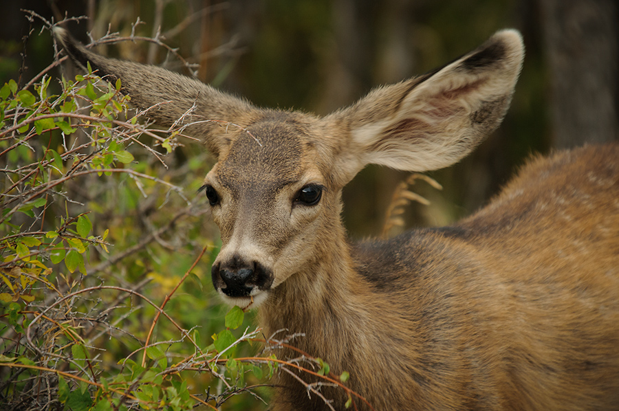
Colorado wildlife: Mule Deer

Mule Deer faun  

I have been asked by a friend, did you make any wildlife photos during your trip in southern Colorado? The answer is yes, although my focus has been really on landscape photography this time. One animal we have spotted almost at every location where we camped was the Mule Deer. Almost every doe had one or two fauns around and it was fun to watch them interact in a playful way with each other. We were wondering why we saw the small Mule Deer herds quite often very close to or in the campgrounds, even if there was open land around as far they eye would go. The predators they have to fear the most are probably Mountain Lions or Coyotes and these guys mostly stay away from humans, hence the deer feels obviously safer in the presence of humans. That doesn’t mean you can walk right up to them and getting out the long lens is still necessary in order to make the click.

I followed this faun for a while as it was munching the leaves from the shrubs and I had quite a few photos to choose from at the end. Why this one? Well, I like how it holds its ears because there is nothing more that says “Mule Deer” as the gigantic ears they have. I hope you enjoy…

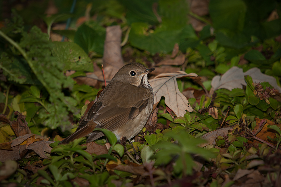
 

Nature clicks #245 - Hermit Thrush, first sighting!

Hermit Thrush  

I like to interrupt my series about Colorado for the report of a first sighting that I had in our woods here on the bluffs above the Little Maquoketa River. I aimed at some American Robins and Cedar Waxwings that came to our bird bath in the front yard this afternoon when I saw this bird foraging on the ground between the leaves. First I thought it was a Fox Sparrow, which we have seen here before, but after reviewing my photos on screen I found out that it was indeed a Hermit Thrush. The bird is obviously on its way to the southern states were it will spend the winter.

The Hermit Thrush wasn’t the only migrating bird that came through here today. Fifteen minutes earlier a Yellow-rumped Warbler landed on a branch right in front of me but I didn’t nail the shot. We live here now since almost ten years and it is amazing to me that we can still add another species to the list of birds we have seen here.


Colorado landscapes: Black Canyon - dealing with an overcast

Black Canyon 4  

My first photo gives you an idea how we saw the Black Canyon of the Gunnison the day after the shots in my last blog post were made. There is nothing exciting about this photo, except maybe for the location itself, but the light is just not very flattering. There wasn’t really a need to make photos that I wouldn’t use anyway here in the blog, in a book, or most important as a large print on the wall. However, I still make these clicks for my own documentation and memory. I want to be able to remember locations and shooting angles in order to be better prepared if I go to the same place another time.

Black Canyon 3


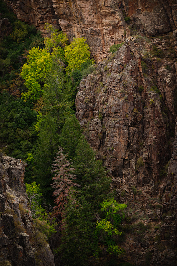
The landscape on the rim of the canyon is desert-like and fresh colors are not there in abundance during an overcast, as easily seen in the first photo. There is much more to the canyon than just the rocks and looking out for other subjects is important on a day like this. The south rim of the canyon is at an altitude of about 2500 m (~8,300 ft) and fall comes early. The first leaves started turning yellow already in the first half of September during our visit and pointing the lens into this gully lead to the photo above.

Painted Wall


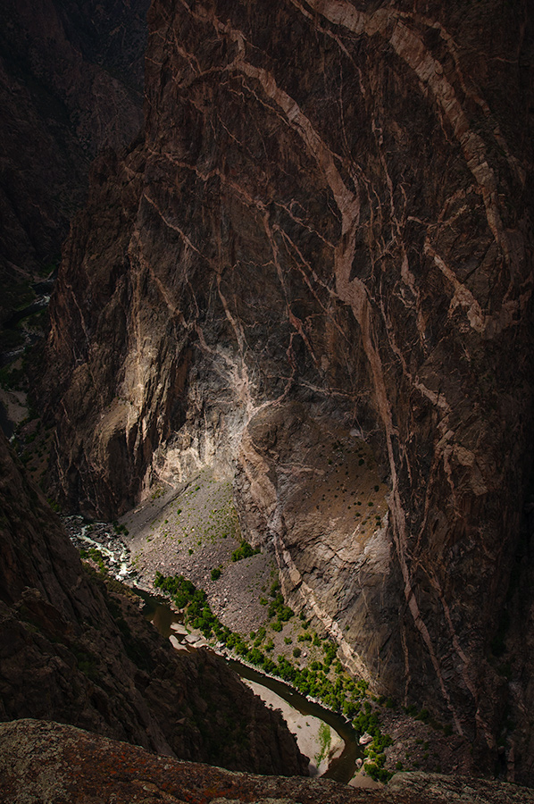
Painted Wall, the highest cliff in Colorado, with its patterns is probably the most iconic view of Black Canyon National Park. These patterns were created more than a billion years ago when molten rock was intruded into fractures and joints in the existing rock, then cooled and hardened. I made several clicks and because of the gray overcast I was thinking black & white for a final image. Everything changed all at once when the sky broke and the sun sent its rays through the layer of clouds to the bottom of the canyon. Suddenly the gigantic rock wall revealed its beauty and told the story why people called it “Painted Wall” much better.

Gunnison River


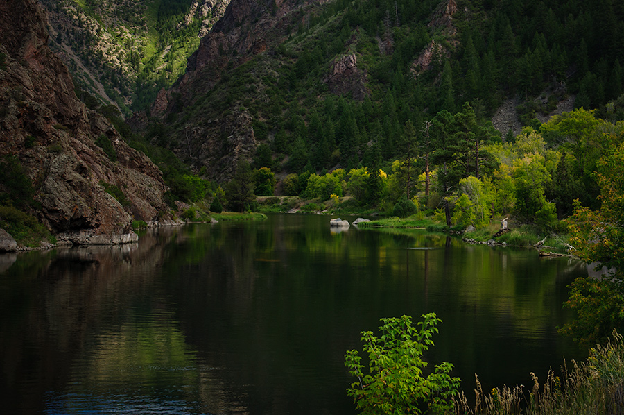
East Portal Road leads to the bottom of the Black Canyon, down to the Gunnison Diversion Dam. A tunnel through the rocks from there to the Uncompahgre Valley delivers water for irrigation since 1909. The water of the Gunnison River at the dam is more quiet and after spending hours up on the dry rim it was a pleasure to see green and yellow reflecting in the cool water...

Colorado landscapes: Black Canyon of the Gunnison

Black Canyon 1  

I introduce our next destination in Colorado with some lines that I found in the National Park brochure.

“Some are longer, some are deeper, some are narrower, and a few have walls as steep, but no other canyon in North America combines the depth, narrowness, sheerness, and somber countenance of the Black Canyon of the Gunnison”,     Wallace Hansen, Geologist

It is indeed an awesome canyon, carved by the Gunnison River. The river loses more elevation within the 48 miles of the Black Canyon than the 1,500-mile Mississippi River from Minnesota to New Orleans.  The gorge is over 800 meters deep and very little sunlight reaches the bottom. The only things that give a sense of scale in my first image are the border stones of the view point on the other side of the canyon, which are about a kilometer away (5/8 of a mile).

Black Canyon 2


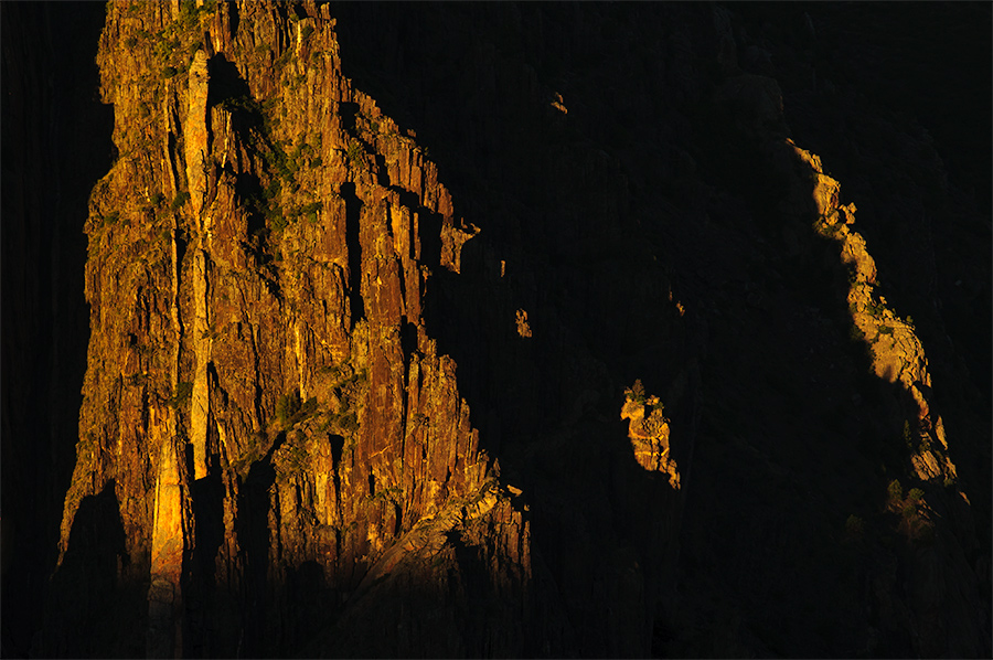
Yes, someone may find a little light in every little crack in these rocks by employing multiple exposures and merging them to a High Dynamic Range photo. I personally prefer to expose strictly for the highlights and use the shadows as an element in the composition of my photo. But that is just me…:-)   The setting sun reveals the structure of these step walls and I consider us very lucky to have such great light the first evening after our arrival in the National Park. More to come...


Colorado landscapes: Cemetery, gold mine, and a ghost town...

Hillside cemetery  

If hiking or mountain climbing is not on your agenda, you still will find many interesting things to do during a stay in the area around Silverton, Colorado. The mining activities over a hundred years ago have left plenty of historical sites and on our last day in the area we visited some of them.

The day started with a clear morning with an almost unreal blue sky and our first stop was the old Hillside Cemetery just outside of Silverton. The headstones tell the stories about the hardships and tragical incidents during the old days. I had to make a photo of this particular one, not just because of the light and background, but my friend and colleague Holly and his family may enjoy my finding. ;-)

Old Hundred Goldmine


Our next stop was the Old Hundred Gold Mine. We didn’t really plan on it, just took a turn off the road to check it out, and before we knew we were sitting in a tram and driving into the darkness of this old mine. Sometimes the spontaneous decisions turn out to be the best and Joe the tour guide did everything to educate us folks. This guy knew definitely what he was talking about and it was very interesting to see him operate some of the equipment.

Animas Forks 1


While driving higher up into the valley the 4-wheel drive of the Subaru became really handy and we finally reached Animas Forks, a ghost town at an altitude of 3400 m (~11,200 ft). The first log cabin was built in 1873 and during the following years the town became a bustling mining community. By 1883 450 people lived in Animas Forks. When mining profits began to decline the town’s mining days were nearing an end. By 1920 Animas Forks was a ghost town. (source: Wikipedia)

It is interesting to visit the abandoned buildings and imagine how life may have been up there during the hay days of mining. Not all of my photography hopes became true. Being at a place like this at high noon isn’t really the best time but sometimes we need to make lemonade out of vinegar. Our time was limited and I think we made the best out of it…

Animas Forks 2


"Leaf peeping" weekend

Leaf peeping  

I interrupt my series about Colorado for an actual “fall adventure”. Joan and I, and of course our dog Cooper, used the nice weather this weekend for tent camping and hiking in the Paint Creek unit of the Yellow River State Forest. This area in northeast Iowa is, like our home, located in the driftless area that escaped the glaciers during the most recent ice ages. As a result it is very hilly terrain and now known as the “Little Switzerland” of Iowa (source: Iowa DNR information map).

Crossing the creek


Beside hiking and having a good time at the campfire we were “leaf peeping” for the colors of the foliage with our cameras. Despite a couple chilly nights I don’t believe we have seen the peak of the colors yet but it is now turning yellow, orange, and red almost everywhere in the woods.

At the camp


Colorado landscapes: Red Mountain

Red Mountain  

Red Mountain in the San Juan Mountains with its three peaks got its name from the reddish iron ore rocks that cover the slopes. The mountains and valleys between Silverton and Ouray, Colorado have been heavily impacted by silver mining in the past. Despite the obvious environmental damage that came with the mining over one hundred years ago, the mountain still bares some beauty because of its color. There are several places along the winding highway where you can stop and study old mining sites and structures. We did this in the morning when we headed towards Ouray but the light was just not right for more than a “touristic snapshot”. Finally on the way back to our campsite in the evening we just timed it right and caught the setting sun making Red Mountain glow…


Colorado landscapes: From South Mineral to Ice Lake

Lower Ice Lake  

From South Mineral Campground near Silverton leads a wonderful trail up to Ice Lake at an altitude of 3736m (12,257 ft). We chose a mostly cloudy day for this hike, which was good for hiking and photography. No dealing with harsh light and hot sun!

We made it


We were told by the very nice campsite hosts that the lake had a wonderful and intensive color and we were not disappointed, despite the gray overcast. Although it was already late in the season we also found many alpine wildflowers up on the tundra.

Ice Lake


Colorado landscapes: Silverton - train depot

Silverton 1  

The next stop on our recent Colorado trip was the area of Silverton. We stayed at a wonderful campsite, just a few minutes away from town and surrounded by high mountains. With 2,836m (9,305 ft) Silverton is one of the highest towns in the United States. It is a former mining camp but has no longer active mining. We had our car but you can reach the town also from Durango, Colorado by a train of the Durango and Silverton Narrow Gauge Railroad, a National Historic Landmark.

You can’t resist the charm of this old mining town, especially around the train depot, where we went the first evening after our arrival…


Silverton train depot 1

Silverton train depot 2

Silverton train depot 3


Colorado landscapes: Mesa Verde - Beyond the historical importance

Mesa Verde  

I think I have not recognized Mesa Verde beyond the fact of its historical importance in my last couple blog posts. I have talked about harsh light during the day, but as soon the sun is near the horizon it is not so difficult to reveal the beauty of this landscape.

If I have the camera on a tripod and all time in the world at my hands, I shoot more than one image of a scene that unfolds in front of me. Most of the photos that evening were much more zoomed in. I just applied the “less is more rule” because my subject was the sunlit rocks. While writing this post, and at the same time making my choice for the image that will be published with it, I recognized that none of the closer views, without the mountains in the background, tells the story about the location of Mesa Verde to those folks that have never been here. So here is my choice for today…